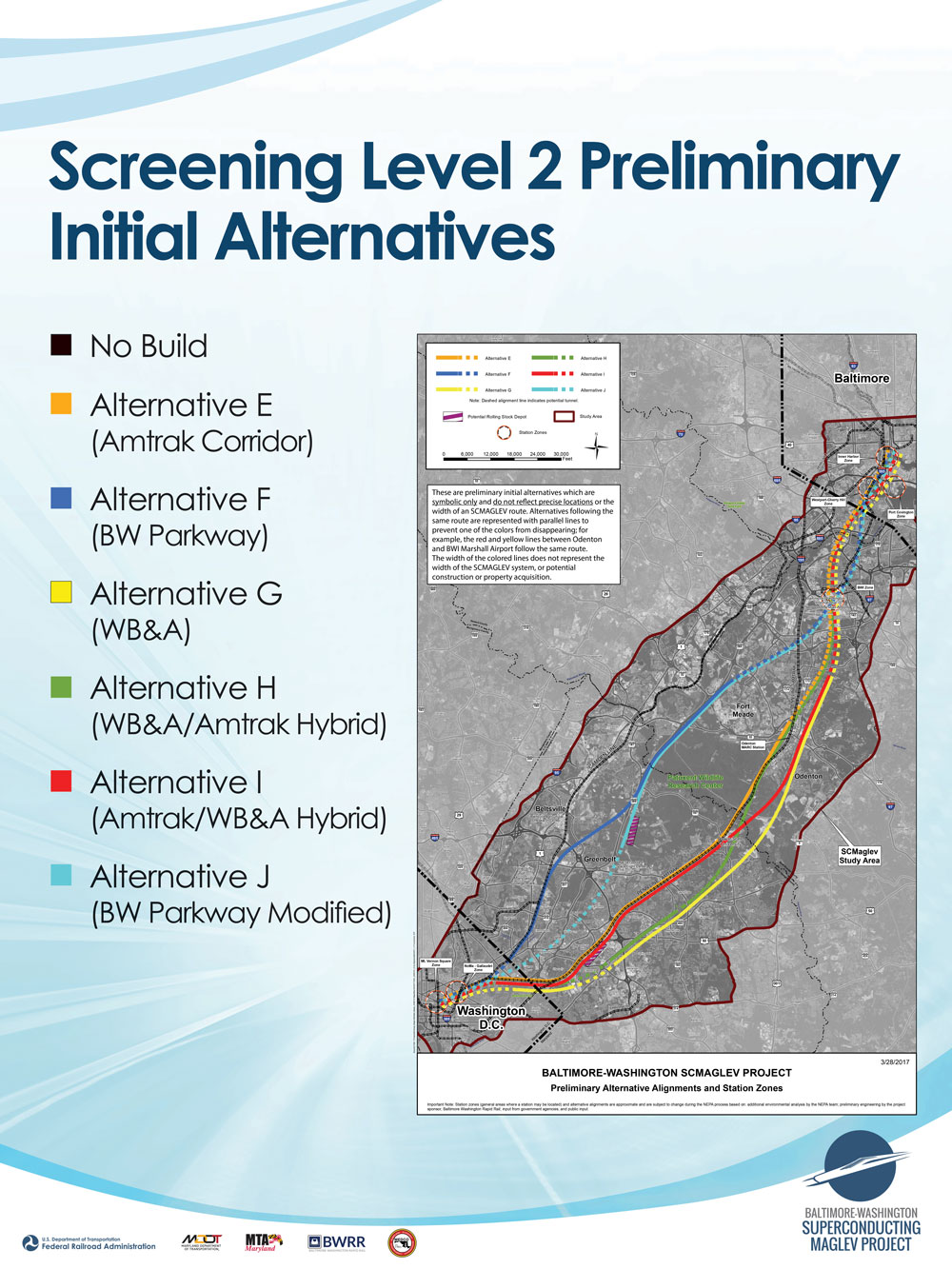
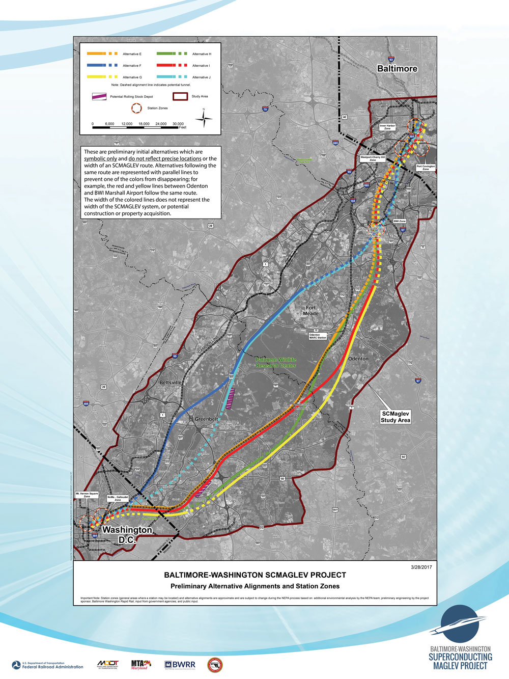
The colored lines representing the various preliminary initial alternatives are symbolic only and do not reflect precise locations or the width of an SCMAGLEV route. Alternatives following the same route as others are represented with parallel lines to prevent one of the colors from disappearing; for example, the red and yellow lines between Odenton and BWI Marshall Airport follow the same route. The width of the colored lines does not represent the width of the SCMAGLEV system, or potential construction or property acquisition. As the NEPA process proceeds, more detailed maps will become available at public meetings and will be posted on the website.
The alignments shown above are “initial preliminary alternatives.” Preliminary means that no decisions by the Federal Railroad Administration (FRA) or Maryland Department of Transportation (MDOT) have been made regarding the alternative alignments. The adjective initial is used because a preliminary alternative may be modified or discarded, and FRA and MDOT may develop additional preliminary alternatives as environmental and community considerations and other factors continue to be assessed. The word alternatives is used because the project team is exploring different possible routes that may reduce environmental impact and improve the project performance. The preliminary nature of the information is explained in a note at the bottom of the map which reads:
Important Note: Station zones (general areas where a station may be located) and alternative alignments are approximate and are subject to change during the NEPA process based on: additional environmental analysis by the NEPA team; preliminary engineering by the project sponsor, Baltimore Washington Rapid Rail; input from government agencies; and public input.
At this time, no decisions by the Federal Railroad Administration (FRA) or Maryland Department of Transportation (MDOT) have been made regarding the alternative alignments that will be carried forward for analysis in the Draft EIS.


